
being page 40 of
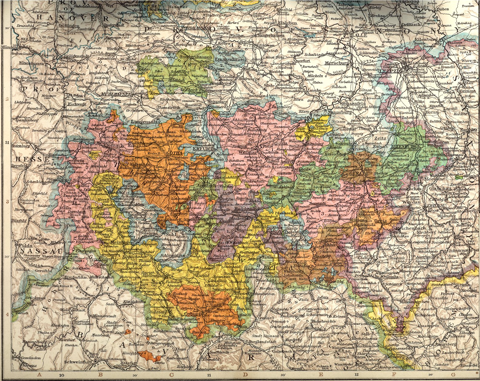
Andrees Handatlas, ed 1., 1881, has a plate "Königreich Sachsen und Thüringische Staaten" (The Kingdom of Saxony and the Thuringian states). The same plate appears in Andrees Handatlas, ed 3., 1896 and presumably also in ed. 2. Like most plates in these atlases, it is printed across two pages.
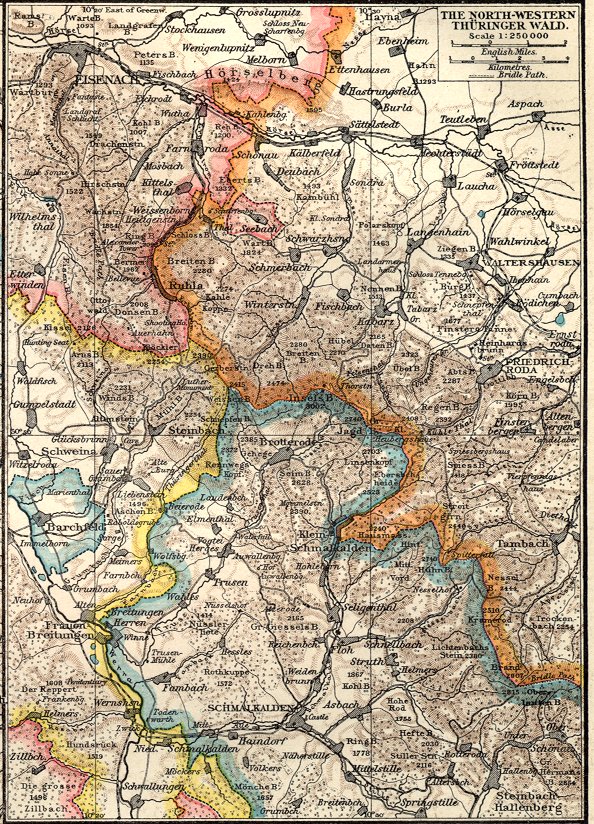
The plates from Andrees Handatlas are also used in Cassell's Universal Atlas of 1893. Most are used in exactly the same way, though often with different colours. However this one plate from Andrees Handatlas is used to provide five seperate maps in Cassells Universal Atlas. On a left-hand page are a map of the Kingdom of Saxony and two insets showing the area around Dresden and the "Saxon Switzerland", and on the facing page are a map of the Thuringian states and an inset showing the area around Brotterode. All five maps are from the same original plate. It is the second page that is reproduced here.
The same plates then appear in The Times Atlas, various editions from 1895 to 1900. This plate is set out in the Times Atlas as it is in Cassell's Universal Atlas.
I do not know why the region around Brotterode, "The North-Western Thüringer Wald", has been included in a world atlas at the large scale of 1:250,000.
There is an error in this particular printing. The northern parts of Schwarzburg-Rudolstadt are shown in blue instead of purple, and the nothern part of Saxe-Coburg-Gotha in yellow instead of orange, because of omission of part of the red plate.
The "four-colour map theorem"A well-known problem in mathematics is "how many colours do you need to colour a map of connected regions on a flat surface so that no two regions with a common border are the same colour?".The answer is "four". It is very hard to prove. A proof is described here, but not given as it is very long. However if the question is stated without the word "connected", then the answer is "infinite". This part of the world did in fact require six colours, as each of these six countries borders the other five:
This state of affairs continued from the redistribution of the Saxon lands in 1826 until the union of the minor Saxon states into the Rebublic of Thuringia in 1920. |
The plate is shown below in four increasing sizes.
This site also has