| Some works by Layla Curtis | ||
| Nordwestdeutschland 1789 from F. W. Putzgers Historischer Schul-Atlas, 1905. | 986 Kb | |
| Südwest Deutschland from Spruner-Menke's Hand-Atlas, 1880. | 2.19 Mb | |
| Thüringen from Cassells Universal Atlas, 1893, and its relevance to the four-colour map theorem. | Original plate | 1.44 Mb |
| Smaller recoloured version that fits in a 1024 by 768 screen | 321Kb | |
| Larger recoloured version that lets you read the town names etc. | 321Kb | |
| Another version of this idea. | ||
| A small map using layers, from F. W. Putzgers Historischer Schul-Atlas, 1905. | 12 Kb | |
| British counties around 1900. | England | 391 Kb |
| Ireland | 444 Kb | |
| Scotland | 442 Kb | |
| Wales | 150 Kb | |
| Japan around 1600. | Moved to http://www.maproom.org | |
| Maps for three Diplomacy variants. | Deluge II | 100 Kb |
| Sahara | 234 Kb | |
| Wall of Ice | 178 Kb | |
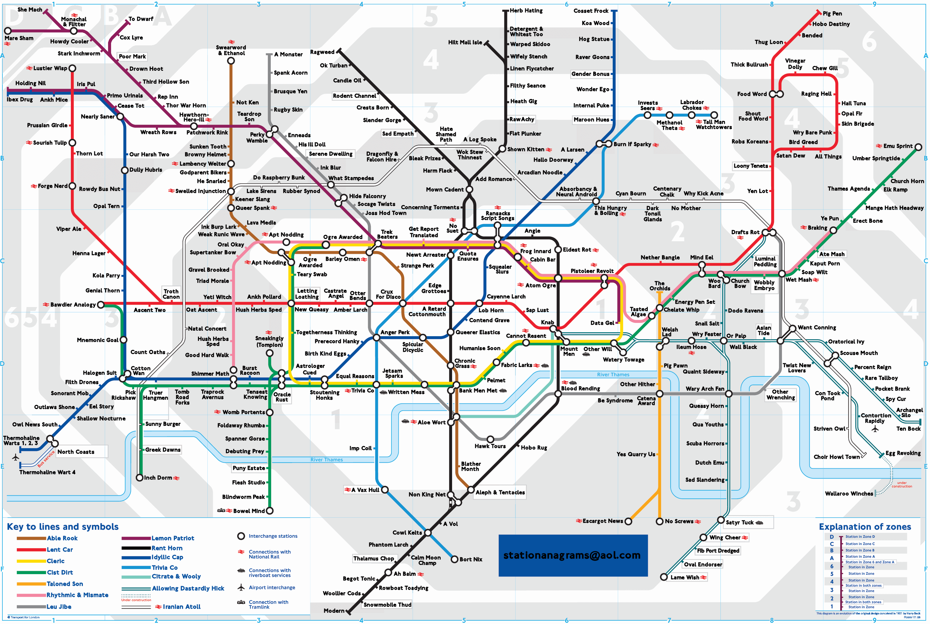
| London Underground, anagrams as formerly available at http://www.unfortu.net/anagrammap/ | 587 Kb | |
Some web sites with good maps:
Back to Nick's home page.